By Julie Noor, Lecturer
Department of Biology, Duke University
On October 3, I attended a workshop at the Life Discovery Conference at San Jose State University lead by John Bailey of Google on the use of Google’s Geo Tools in Education. Here’s a brief summary of the tips and tricks he showed us. More information about these tools can be found at https://www.google.com/earth/outreach/tools/index.html and https://sites.google.com/site/geobrowsing/google-geo-tools with some great tutorials on Google Earth and Google Maps at https://www.google.com/earth/outreach/tutorials/index.html.
Google Earth
Google Earth was one of the most familiar tools to me and the rest of the audience, so it was touched on very briefly. However Bailey did show us a couple of tricks I hadn’t seen before (click images for higher resolution versions).
- You can generate an elevation profile! Simply draw a path then right click on it and choose “Get (or Show on a Mac) Elevation Profile.”


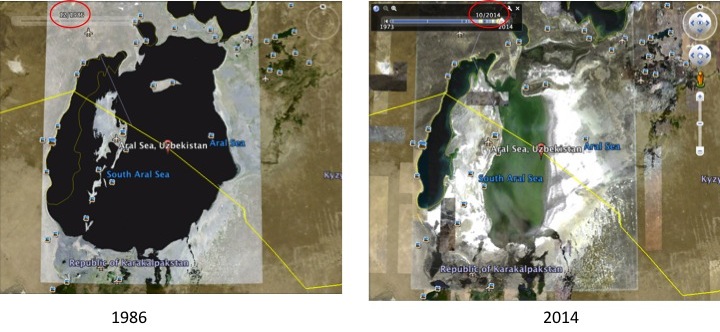
- It’s possible to view not just the most current satellite imagery, but also historic imagery. This is great for mapping deforestation, reduction of glaciers, shrinkage of water bodies, etc. Click on the icon of a clock moving backwards, then adjust the slider to older images.

Google Maps: My Maps
(https://www.google.com/maps)
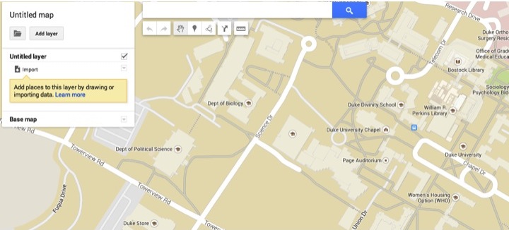
Bailey also showed us some potentially interesting tricks in the My Maps tool of Google Maps. (images based on the new My Maps https://mapsengine.google.com/projects/new)
- You can add markers to a map with data imported from Google Form, and if configured correctly, this can be dynamic so that the markers are constantly updated as new forms are submitted. The example he used was our favorite national parks. We each submitted a Google Form he’d set up with the name of our favorite park, then when he imported it, there were markers on each of our favorites. This would be a fun way for students to illustrate where they’re from, but more useful, it could be a way of entering where samples had been collected, events occurred (historic or current), etc.

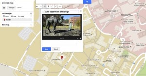
- You can add any image(s) on the internet to the information balloon of an added marker. So students can add images of samples or specific location to the marker they submitted. This can be an image that you have uploaded to Google+, Flickr, etc or one you find via Google Image search (as I did below).

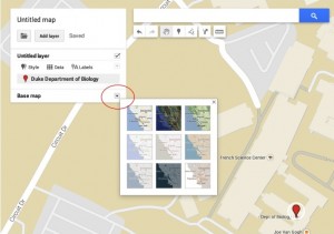
- The base map can be changed to road, satellite, hybrid, outlines, etc. Click on the down arrow next to “Base map” and click on the option that you want.
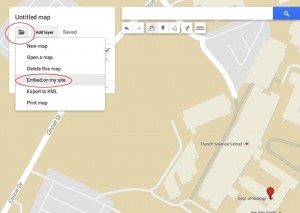
- The map can be embedded on webpage: click on the folder icon just under the title of the map, then on “Embed on my site.”
- The map can be printed in different sizes and outputs: click on the folder icon just under the title of the map, then on “Print map.”
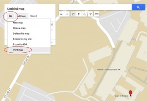
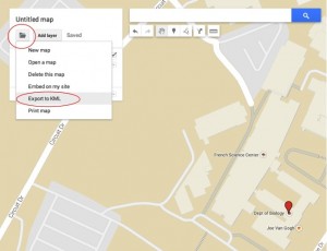
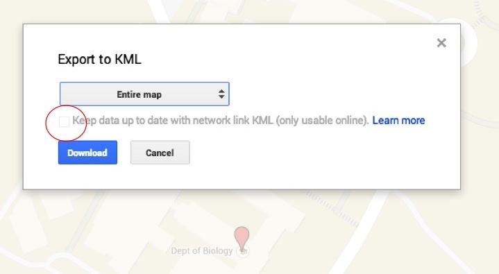
- Or the map can be exported to KML so it can be added to Google Earth. If the map includes data from a form or other source so that it is dynamic, you can get a network link so that it is refreshed with new data (only works with an internet connection). Click on the folder icon just under the title of the map, then on “Export to KML.” If you want a network link that checks for new data, check the box next to the option (option is only available if the map is importing data).


Views
(https://maps.google.com/views)
All photos in Google+ that are publically viewable and geo located (tagged with a location) can be found in Views. I actually find this terrifying and appalling, but if you’re looking for photos of a particular location, this is a good resource.
Tour Builder
(https://tourbuilder.withgoogle.com/)
TourBuilder let’s you tell a story on a map. I saw the most potential in this tool as it provides a powerful alternative for instructor or student presentations that have a strong location component. You can get a good idea of the possibilities by looking at this example: https://tourbuilder.withgoogle.com/builder#play/ahJzfmd3ZWItdG91cmJ1aWxkZXJyDAsSBFRvdXIYuLcFDA
- Link or upload photos & videos, add text descriptions, etc (up to 25 images to one marker)
- Add historical imagery to tour
- Tutorial: https://www.google.com/earth/outreach/tutorials/tourbuilder.html
Earth Engine
(https://earthengine.google.org/)
Earth Engine is a platform for mining data from Google’s satellite imagery. Bailey touched on it very briefly, so I didn’t get a good sense of it’s potential, but seems like it could be worth investigating. The gallery includes timelapse maps of deforestation and glacier retreat and precomputed datasets of forest canopy damage and persistent surface water.
Nice post!!Google Geo Tools is very popular and very useful in education.It contain more tools like Google Earth,Earth Engine,
Google Maps and all.thank you so much for sharing this information.
Technology Blog
Great sharing about Google Geo Tool thanks
thanks, very good article
Great posting!!Google Geo Tools is very very useful in for all peaple. thanks for this sharing